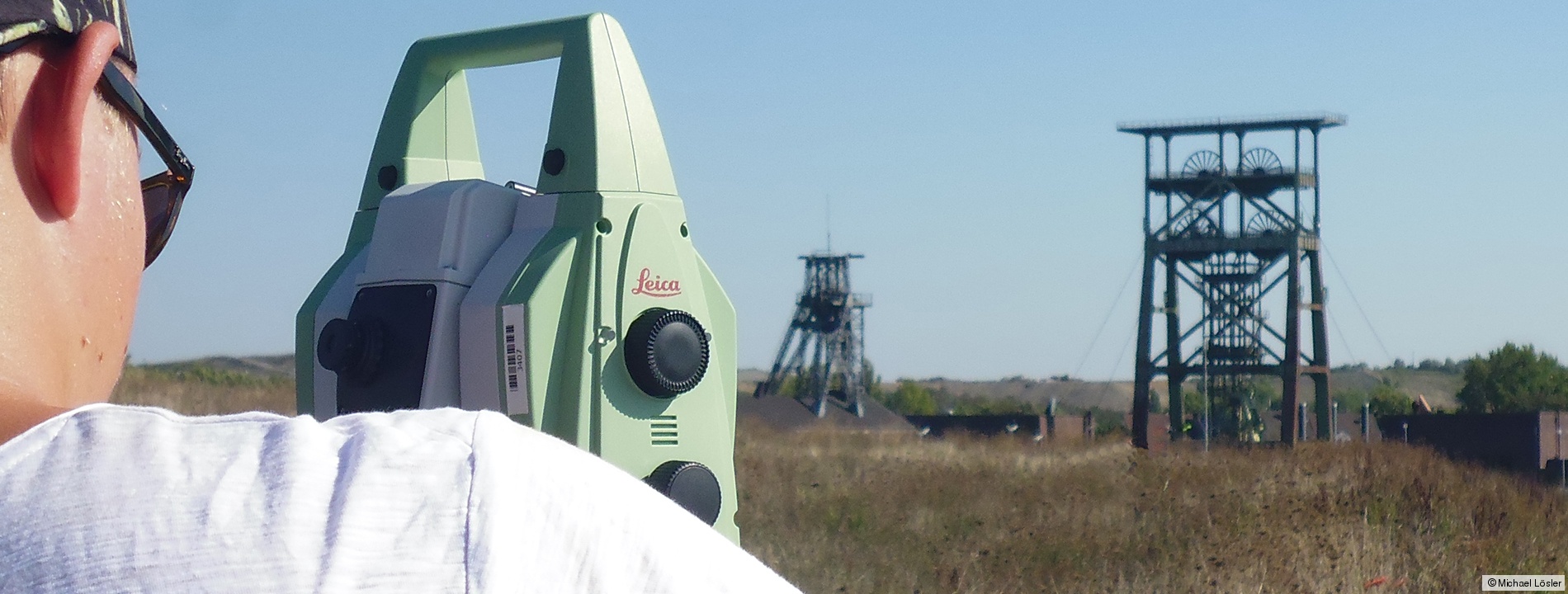
Congruence analysis in engineering geodesy
According to German norm DIN 18710, the expertise in the field of applied engineering geodesy and metrology are surveying and staking out of objects, as well as deformation analysis. Surveying deals with the survey of spatial and topological data describing the current state of an observed object. In contrast to surveying, staking out transforms a digital virtual object into the locality. Monitoring systems are able to detect spatio-temporal deformations of an object. Hence, deformation analyses ensure the operational and structural safety of objects, and - under certain conditions - allows the derivation of appropriate preventive measures. The most important method in the framework of deformation analyses is the congruence analysis.
Research focus
The Laboratory for Industrial Metrology develops algorithms and software solutions. In the framework of monitoring, the goal of our software engineering is a high degree of automation. The laboratory focuses on applications that are not sufficiently represented by commercial products, namely network adjustment and congruence analysis. Congruence analysis includes, for instance, the point-based monitoring of dams or mines, but also the surface analysis like the deformation analysis of main reflectors of VLBI radio telescopes.
In close scientific cooperation with HTW Dresden, the Laboratory for Industrial Metrology investigates alternative statistical approaches to reliably detect significant deformations of an observed object, following Baarda's postulates of detection, identification and adaptation (DIA). Moreover, methods from descriptive statistics such as multiple hypothesis testing or p-value criterion, as well as information criteria such as Akaike information criterion (AIC) or Bayesian information criterion (BIC) are investigated and are evaluated in the framework of congruence analysis.
Lösler, M., Eschelbach, C., Lehmann, R.: Impact of Mathematical Correlations - Exemplified in Industrial Applications. Journal of Applied Geodesy, 2025. DOI: 10.1515/jag-2025-0040
Lehmann, R., Lösler, M.: Internal reliability of planar coordinate transformations. Journal of Surveying Engineering, 150(3), 2024. DOI: 10.1061/JSUED2.SUENG-1498
Durand, S., Lösler, M., Jones, M., Cattin, P.-H., Guillaume, S., Morel, L.: Quantification of the dependence of the results on several network adjustment applications. In: García-Asenjo, L., Lerma, J. L. (eds.): 5th Joint International Symposium on Deformation Monitoring (JISDM), Editorial Universitat Politècnica de València, Spain, pp. 69-77, 2022. DOI: 10.4995/JISDM2022.2022.13671
Neitzel, F., Lösler, M., Lehmann, R.: On the consideration of combined measurement uncertainties in relation to GUM concepts in adjustment computations. Journal of Applied Geodesy, 16(3), pp. 181-201, 2022. DOI: 10.1515/jag-2021-0043
Lehmann, R., Lösler, M., Neitzel, F.: Mean Shift versus Variance Inflation Approach for Outlier Detection - A Comparative Study. Mathematics, Stochastic Models for Geodesy and Geoinformation Science, 8(6), 991, 2020, DOI: 10.3390/math8060991
Lösler, M., Lehmann, R., Neitzel, F., Eschelbach, C.: Bias in Least-Squares Adjustment of Implicit Functional Models. Survey Review, 53(378), pp. 223-234, 2021. DOI: 10.1080/00396265.2020.1715680
Lehmann, R., Lösler, M.: Hypothesis testing in non-linear models exemplified by the planar coordinate transformations. Journal of Geodetic Science, 8(1), pp. 98-114, 2018, DOI: 10.1515/jogs-2018-0009
Lehmann, R., Lösler, M.: Congruence analysis of geodetic networks - hypothesis tests versus model selection by information criteria. Journal of Applied Geodesy, 11(4), pp. 271-283, 2017, DOI: 10.1515/jag-2016-0049
Lösler, M., Lehmann, R., Eschelbach, C.: Modellselektion mittels Akaike-Informationskriterium - Anwendung in der Kongruenzanalyse. avn - Zeitschrift für alle Bereiche der Geodäsie und Geoinformation, 124(5), pp. 137-145, 2017.
Lehmann, R., Lösler, M.: Multiple Outlier Detection: Hypothesis Tests versus Model Selection by Information Criteria. Journal of Surveying Engineering, 142(4), 2016, DOI: 10.1061/(ASCE)SU.1943-5428.0000189
References from applied science
In the following some scientific reference projects of the Laboratory for Industrial Metrology are presented. The presented applications focus on surveying engineering, automated monitoring, as well as congruence analysis.
Surveying and monitoring of tide gauges and mareographs
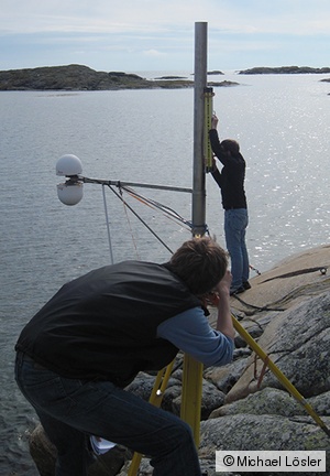
A large-area levelling network was measured at the Onsala Space Observatory (OSO) to combine tide gauges and mareographs with the official height reference frame of the Swedish national survey. The network was repeated measured to validate the stability of the tide gauges and mareographs. For that purpose, statistically based congruence analyses were performed using the in-house developed adjustment software package Java·Applied·Geodesy·3D (JAG3D). The conduced measurement epochs of the OSO levelling network were rigorous analysed by a congruence analysis on the observation level implemented in JAG3D. In addition to the analysis of single point deformations, advanced congruence analyses were performed to check the network for block-shifts or network strains.
Lösler, M., Eschelbach, C., Haas, R.: Kongruenzanalyse auf der Basis originärer Beobachtungen. Zeitschrift für Geodäsie, Geoinformatik und Landmanagement (ZfV), 142(1), pp. 41-52, 2017, DOI: 10.12902/zfv-0147-2016
Monitoring of UAS reference point fields
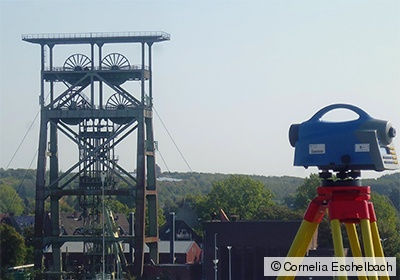
Unmanned Aircraft Systems (UAS) are used for low-cost and rapid surveying of small areas in a detailed manner. The accuracy of the resulting point cloud derived from aerial images depends on several components, for instance, the stability of the camera or the calibration parameters. The datum, i.e. the position, the orientation and the scale, of the point cloud is realised by reference and control points at the ground. For that reason, the spatial distribution and accuracy of these reference and control points affect the accuracy of the UAV point cloud. To evaluate UAS in the framework of monitoring measurements, a reference point field was initiated by RAG Deutsche Steinkohle AG (RAG) and the Laboratory for Laser Scanning, Photogrammetry and Remote Sensing. The Laboratory for Industrial Metrology obtained reference values by precise levelling and terrestrial measurements.
Lösler, M., Eschelbach, C., Spreckels, V., Schlienkamp, A., Greiwe, A., Peters, J.: Anlegung eines Vergleichspunktfeldes zur Validierung von UAS – Planung, Realisierung und Überwachung. In: Luhmann, T., Schumacher, C. (eds.): Photogrammetrie - Laserscanning - Optische 3D-Messtechnik: Beiträge der 16. Oldenburger 3D-Tage 2017. ISBN: 978-3-87907-625-3
Greiwe, A., Peters, J., Spreckels, V., Schlienkamp, A., Lösler, M., Eschelbach, C.: Geeignete Kameras zur Geländeaufnahme durch UAS. In: Luhmann, T., Schumacher, C. (eds.): Photogrammetrie - Laserscanning - Optische 3D-Messtechnik: Beiträge der 16. Oldenburger 3D-Tage 2017, Wichmann, pp. 202-221, 2017, ISBN: 978-3-87907-625-3
Automated IVS and ILRS reference point determination
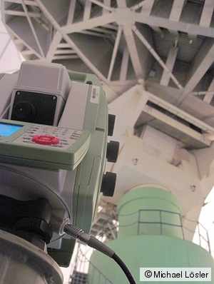
The monitoring system High-End Interface for Monitoring and spatial Data Analysis using L2-Norm (HEIMDALL) is a modular software package developed by the Laboratory for Industrial Metrology. HEIMDALL focuses on an automated and continues reference point determination of telescopes used for Very Long Baseline Interferometry (VLBI) and Satellite Laser Ranging (SLR). The software controls several measurement sensors such as total stations or laser trackers. The data administration and management is realised by a Structured Query Language (SQL) database. For data analysing the in-house network adjustment software package JAG3D is integrated as well as analysis toolboxes for reference point determination, recursive parameter estimation and Kalman filter. HEIMDALL has been successfully tested at Metsähovi Radio Observatory (Finland) and Onsala Space Observatory (Sweden). Since 2013, HEIMDALL is used at Geodetic Observatory Wettzell for regular reference point determinations of the VGOS-specified TWIN radio telescopes.
Mähler, S., Klügel, T., Lösler, M., Schüler, T.: Permanentes Referenzpunkt-Monitoring der Radioteleskope am Geodätischen Observatorium Wettzell. avn - Zeitschrift für alle Bereiche der Geodäsie und Geoinformation, 125(7), pp. 210-219, 2018.
Kallio, U., Lösler, M., Bergstrand, S., Haas, R., Eschelbach, C.: Automated simultaneous local ties with GNSS and robot tachymeter. In: Behrend, D., Baver, K. D., Armstrong, K. L. (eds.): Proceedings of the 9th IVS General Meeting, New Horizons with VGOS, 13-19 March 2016, Johannesburg, South Africa, pp. 154-158, 2016. NASA/CP-2016-219016
Lossin, T., Lösler, M., Neidhardt, A., Lehmann, R., Mähler, S.: The usage of recursive parameter estimation in automated reference point determination. In: Behrend, D., Baver, K. D., Armstrong, K. L. (eds.): Proceedings of the 8th IVS General Meeting - VGOS: The New VLBI Network, Science Press (Beijing), 2-7 March 2014, Shanghai, China, pp. 344-348, 2014. ISBN: 978-7-03-042974-2
Neidhardt, A., Lösler, M., Eschelbach, C., Schenk, A.: Permanent monitoring of the reference point at the 20 m radio telescope Wettzell. In: Behrend, D., Baver, K.D. (eds.): Proceedings of the 6th IVS General Meeting, VLBI2010: From Vision to Reality, Hobart, TAS, Australia, 7-13 February 2010, pp. 133-137, 2010, NASA/CP-2010-215864
Convergence measurements in mining
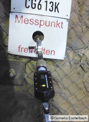
For continuous deformation measurements at the pit Konrad in Salzgitter, the federal company for radioactive waste disposal (Bundesgesellschaft für Endlagerung mbH, BGE) uses an extensive geo-monitoring system. The system was introduced to monitor the rebuilding and construction phase of the pit. Due to local conditions, the some of the total stations are installed overhead. To analyse the terrestrial data, the Laboratory for Industrial Metrology provided the adjustment engine, which was fully integrated in the BGE geo-monitoring system. The analysis software is designed to analyse the data automatically. Moreover, an automated congruence analysis is performed to validate the invariance of the reference point field w.r.t. to a reference epoch. Due to the non-specified use of the total stations, the embedded tilt compensators cannot be used to compensate for the inclinations of the instruments. For that reason, each instrument station has six degrees of freedom. The developed software takes these degrees of freedom into account and adjusts the network on the observation level.
Lösler, M., Eschelbach, C., Jarecki, F.: Evaluation and analysis strategy for automated underground monitoring measurements. In: Benndorf, J. (ed.): 19th Geokinematic Day. Schriftenreihe des Instituts für Markscheidewesen und Geodäsie der TU Freiberg, Issue 2018-1, pp. 64-78, 2018. ISBN: 978-3-938390-21-4
Jarecki, F., Busse, V., Lösler, M., Eschelbach, C.: Tachymetrische Verformungsbeobachtung bei Teufenarbeiten: Instrumentierung, Automatisierung und Auswertung. In: Benndorf, J. (ed.): 19. Geokinematischer Tag. Schriftenreihe des Institutes für Markscheidewesen und Geodäsie der TU Freiberg, Issue 2018-1, pp. 53-63, 2018. ISBN: 978-3-938390-21-4
Prof. Dr.-Ing.
Cornelia Eschelbach
Phone: +49 (0) 69 1533-2356
cornelia.eschelbach(at)fra-uas.de
Dr.-Ing.
Michael Lösler
Phone: +49 (0) 69 1533-2784
michael.loesler(at)fra-uas.de
Address
Transfer centre
Steinbeis Transfer Centre Applied Geodesy
https://applied-geodesy.org
Member of SCGD
Member of the Society for Calibration of Geodetic Devices e.V. (SCGD)

