Research and Development
Least-Squares Adjustment and Parameter Estimation

In most cases, desired quantities cannot be observed by means of direct observations, and the parameters must be obtained indirectly. To ensure precision and to increase reliability usually more measurements are conducted than needed for the unique determination of the parameters. An over-determined system of equations is to be solved. The most common approach to solve such systems of equations was developed by Gauss and Legendre and is known as least-squares adjustment. The method has been adopted as a standard analysis procedure in geodesy and metrology.
For the analysis of geodetic observables such as leveling data, sets of directions or distances, the network adjustment software package Java·Applied·Geodesy·3D (JAG3D) has been developed since 2007. JAG3D is one of the most popular and comprehensive open source least-squares software packages for geodetic and metrological sciences. It is designed to combine hybrid terrestrial observations in vertical, horizontal and spatial networks. The adjustment software supports a congruence analysis of two measurement epochs on the observation level. Network deformations or network strains are analysed by means of statistical hypothesis tests, following Baarda's postulates of detection, identification and adaptation (DIA).
In large-volume metrology, instruments such as laser trackers are unrelated to the local plumb line of the Earth. The implemented adjustment model parametrizes the deflections of the vertical, and allows for a rigorously combination of raw observations w.r.t. an arbitrarily oriented object based reference frame. In particular, measurements obtained in unstable environments like a floating dock can be strictly combined by the integrated mathematical model of the JAG3D application.
Reverse Engineering

Parameterizing of a measured object by geometric primitives is one of the most important tasks in industrial metrology and is knows as reverse engineering. The Laboratory of Industrial Metrology uses, for instance, the MultiStation (MS50) for reflector-less measurements of an object. For high-precision measurements two laser trackers are available, namely the mobile laser tracker AT401 (Hexagon/Leica) and the absolute laser tracker Omnitrac2 (API). Both instruments yield measurements with an uncertainty of up to 20 µm. Similar uncertainties can be obtained by the high-precise photogrammetric measurement system DPA Industrial (Aicon/Hexagon).

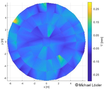
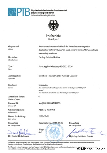
Reverse Engineering yields the geometric parameters of an object like dimension, form-fit as well as orientation. The residuals quantify the deviation of an object w.r.t. to the specification and are important in quality inspections. The curve and surface analysis toolbox is the key component in reverse engineering, and yields the parameters to be estimated by means of least-squares adjustment. In particular accelerator networks, for instance, the curve and surface analysis is applied to reconstruct path components of the accelerator beamline by e.g. double-cylinders. The receiving properties of VLBI radio telescopes depend on the surface quality of the main reflector. The reflector of an modern VGOS radio telescope is parameterized by a double-elliptic ring-focus-paraboloid. Quadratic programming, which belong to the group of errors-in-variables (EIV) models and are the most important class of numerical solvers, are used to estimate curve and surface parameters. The implemented algorithms for best fit of form elements of control geometries have been successfully verified by the Physikalisch-Technische Bundesanstalt (PTB).
Reference Point Determination at Space Geodetic Techniques

The International Terrestrial Reference Frame (ITRF) is the most precise realisation of a global Earth-fixed reference frame. The ITRF is obtained by combining several space geodetic techniques such as:
- Global Navigation Satellite System (GNSS),
- Satellite Laser Ranging (SLR),
- Very Long Baseline Interferometry (VLBI), and
- Doppler Orbitography and Radiopositioning Integrated by Satellite (DORIS).
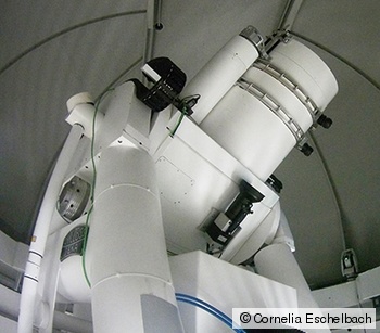
Crucial parts of the combination process are so-called local ties. Local ties are vectors defining the relative distances and orientations of the reference points of the hosted space geodetic techniques at multi-technique stations. These reference points are observable at multi-technique stations using high-precision terrestrial measurements and photogrammetric approaches. The local ties and the related fully populated dispersion are introduced to the global combination process to overcome the weak physical connection between the space geodetic techniques. Since discrepancies of local ties bias the global results, the Global Geodetic Observing System (GGOS) calls for high-precise and reliable vectors. Whereas the reference points of GNSS antennas and DORIS beacons can be determined by direct measurements, the determination of the reference points of telescopes used for VLBI and SLR is a challenging metrological task.
The VLBI and SLR reference points can only be obtained by indirect approaches. Moreover, the GGOS calls for an almost automated and continuous reference point determination during the regular station process. For that propose, innovative analysis approaches, e.g. Kalman filter, and novel observation strategies need to be developed and evaluated. First successful investigations of a permanent in-situ reference point monitoring took place at Onsala Space Observatory (Sweden), Metsähovi Radio Observatory (Finland), and Geodetic Observatory Wettzell (Germany).
Teaching
Lecture of the module Least-Squares Adjustment as well as supervision of exercises and theses in the degree program Geodata Management with the main focus on
- Reference Systems,
- Parameter Estimation and Least-Squares Adjustment,
- Surveying Engineering, and
- Industrial Metrology,
as well as processing of scientific projects and preparation of research studies within the Laboratory of Industrial Metrology.
Membership
Member of the International Association of Geodesy (IAG) and the national associations: Deutscher Verein für Vermessungswesen - Gesellschaft für Geodäsie, Geoinformation und Landmanagement (DVW e.V.), as well as the joint Working Group on Site Survey and Co-location of the International Earth Rotation and Reference Systems (IERS) and the IAG.
Dr.-Ing.
Michael Lösler
Phone: +49 (0) 69 1533-2784
michael.loesler(at)fra-uas.de
Transfer centre
Steinbeis Transfer Centre Applied Geodesy
https://applied-geodesy.org

